December 2018 (1AUD=0.7USD):
This trip was during year-end holidays in 2018. We drove around Red Centre Way in Australia by rental car for 5 days in this area. We used an Optus prepaid SIM card for communication. We reserved a rental car online in advance, rented it at Ayers Rock Airport and returned it at Alice Springs Airport. We rented a 4WD to be able to drive on unpaved roads. We had to refrain from doing activities because it was extreme heat, over 45 degrees (113 degrees Fahrenheit), for days.
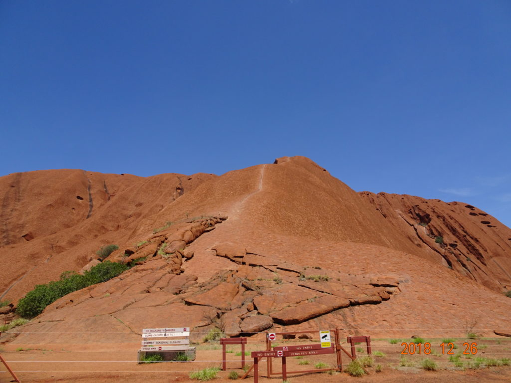
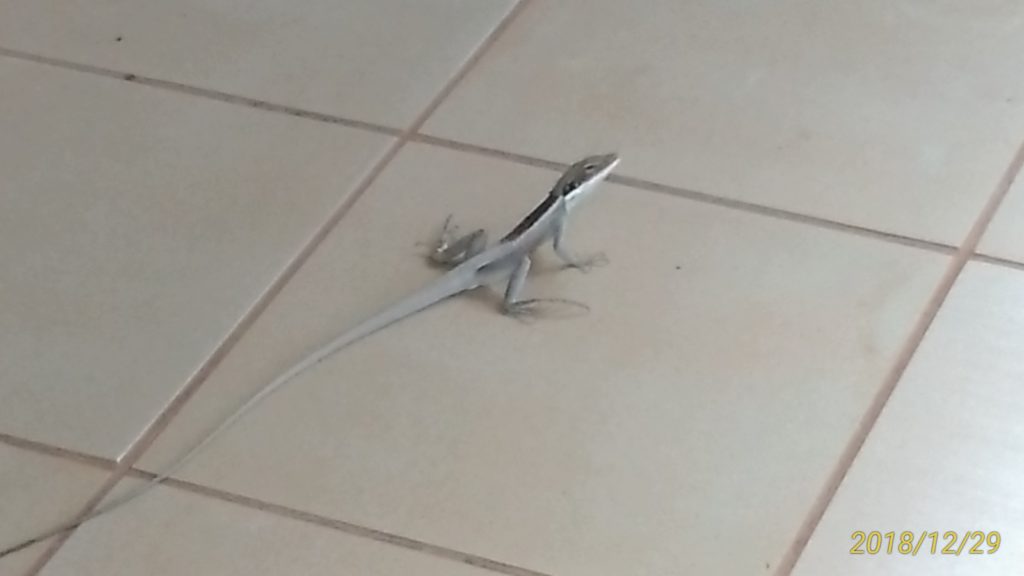
As flies flew around our faces, fly nets were necessities. Climbing Uluru will be banned in Oct 2019, but we could climb it at this time.
Itinerary
Pre-trip day: Narita International Airport – Melbourne International Airport
1st day: Melbourne Airport – Ayers Rock Airport – Uluṟu-Kata Tjuṯa National Park
2nd day: Uluṟu-Kata Tjuṯa National Park
3rd day: Uluṟu-Kata Tjuṯa National Park – Watarrka National Park
4th day: Watarrka National Park – West MacDonnell National Park
5th day: West MacDonnell National Park – Alice Springs Airport – Melbourne Airport
Pre-trip day: Wed, December 26
We arrived at Melbourne International Airport after 11 P.M. We purchased a SIM card at the communication company, Optus, and inserted it there. We stayed at Holiday Inn near the airport.
1st day: Thurs, December 27
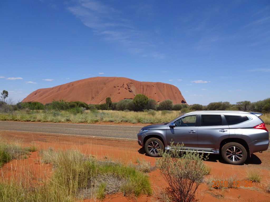
We moved from Melbourne Airport to Ayers Rock Airport in the morning. After renting a Pajero 4WD, we arrived at Ayers Rock Resort in about a half-hour. It was 47 degrees. After buying some water bottles, we went ahead to the trailhead of Uluru, Ayers Rock Climb CarPark. We bought entrance tickets valid for 3 consecutive days (A$25/adult) at the park entrance. After that, we could enter the park by barcode authentication.
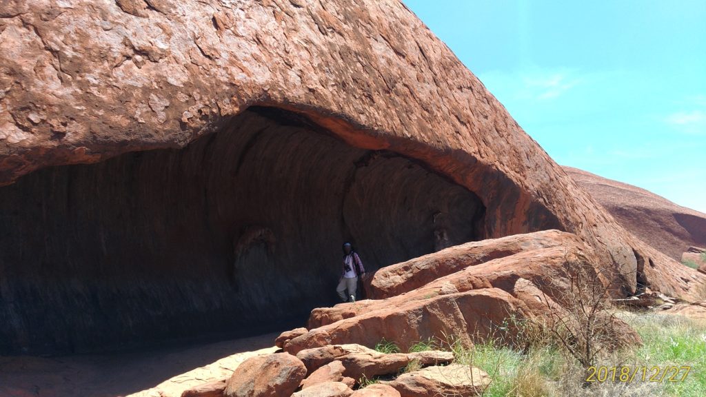
We were scheduled to walk around the bottom of Uluru this day, but we went around main points by car because of the heat. In spite of doing so, we consumed a lot of energy, so we rested at a cafe in the cultural center. The Aboriginal people were drawing Aboriginal arts and we were able to see their art, and there was also a souvenir shop, so we enjoyed ourselves beyond expectation.

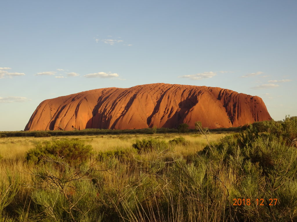
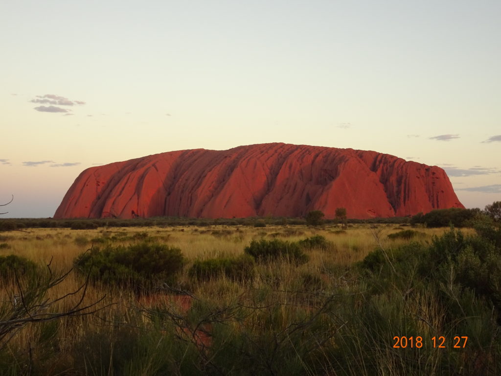
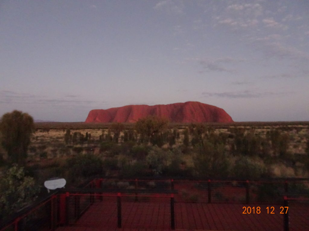
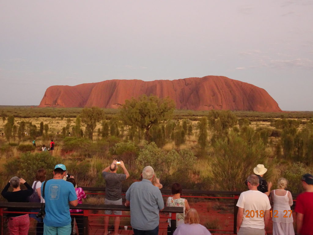
We returned to the resort once before the sunset. We checked in at Outback Pioneer Lodge and took a shower. We arrived at the Uluru car sunset viewing area around 6 P.M. We got there too early because we were worried about parking spaces, but we still enjoyed seeing Ayers Rock, which was changing every second.
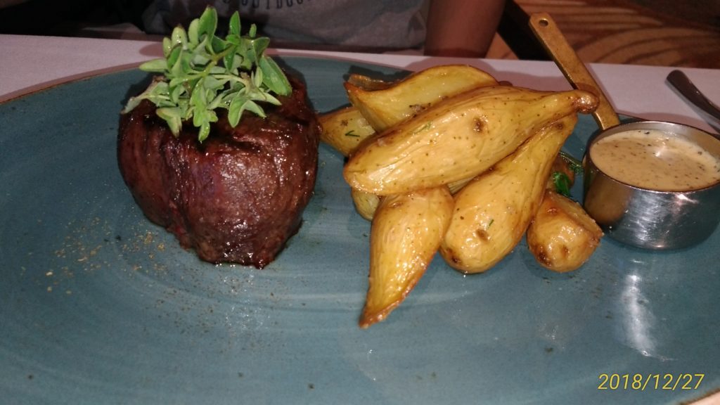
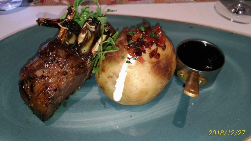
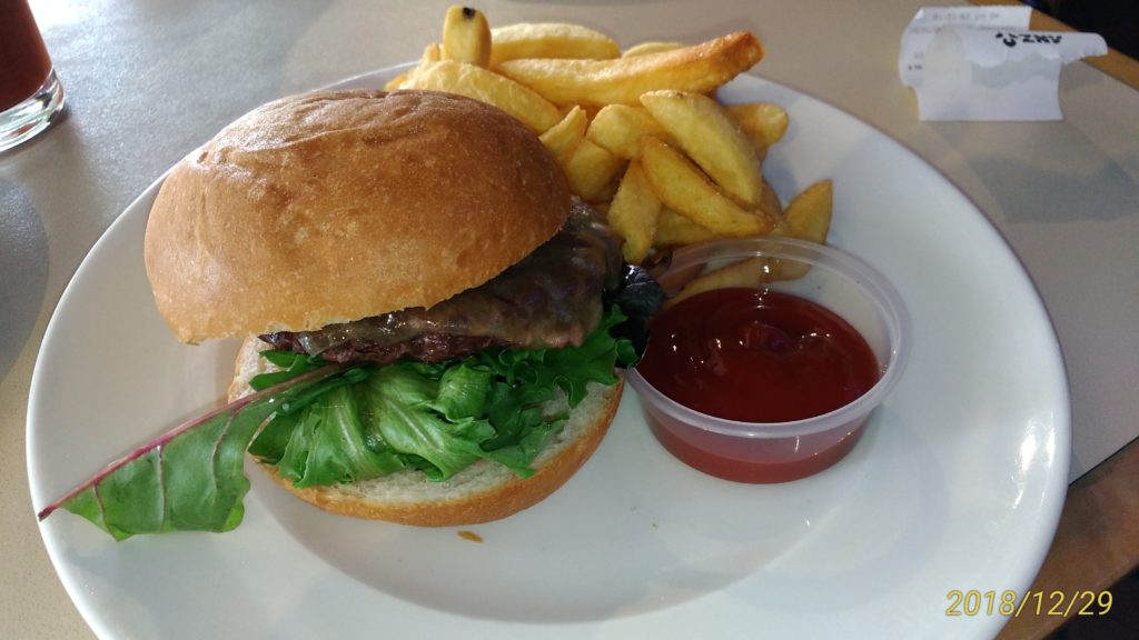
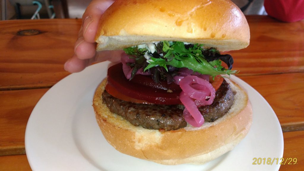
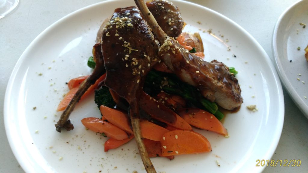
We returned to the resort and parked our car at the lodge’s car park, and had dinner at Arnguli Grill & Restaurant, which we had reserved. It was A$160.5 (approx.$112) for 4 glasses of alcohol, an emu meat appetizer, and 2 main dishes.
09:00 Leave Melbourne Airport
10:30 Arrive at Ayers Rock Airport
11:30 Ayers Rock Resort
12:30 Stroll around the bottom of Uluru
17:30 Check-in at Outback Pioneer Lodge
19:30 Uluru sunset
20:30 Dinner at Arnguli Grill & Restaurant
2nd day: Fri, December 28
We went ahead to the Talinguru Nyakunytjaku viewing area to see the sunrise. We couldn’t see the sunrise itself but could see Uluru changing from the sunlight.
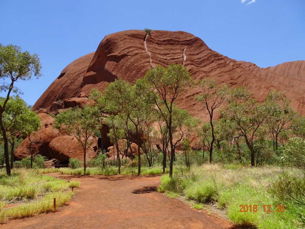
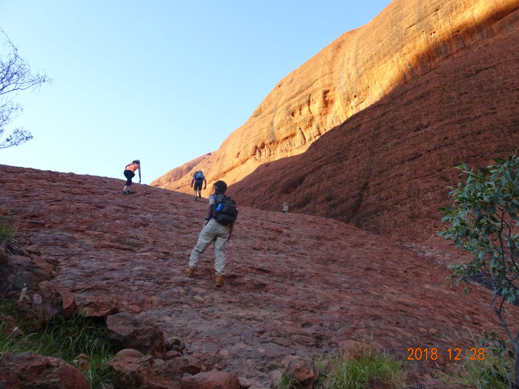
After that, we went ahead to the trailhead of Uluru quickly. The probability of us entering the mountain was low in December, but if all conditions were met, the gate would open by about 8 A.M. Wearing our hiking shoes, we waited over 30 mins, fully prepared. Just as we were thinking we would never climb, a ranger came and opened the gate. We started to climb immediately before the temperature rose.
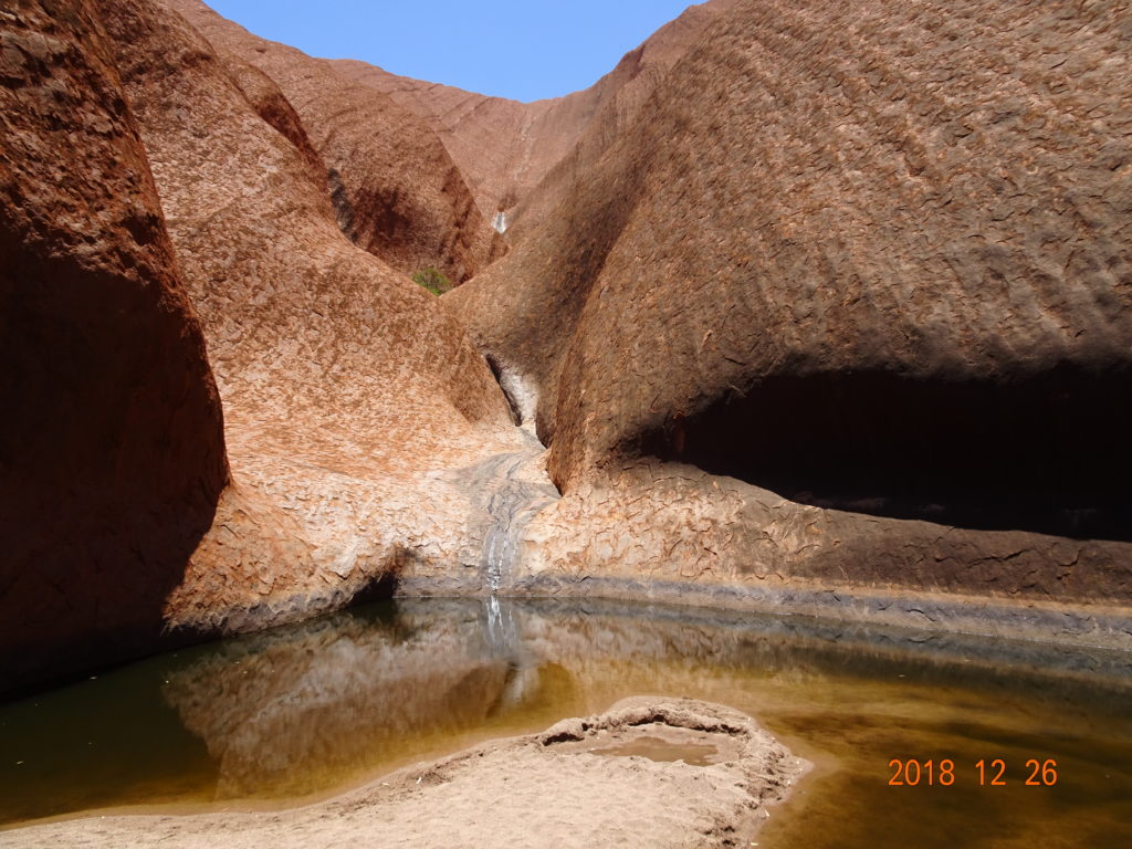
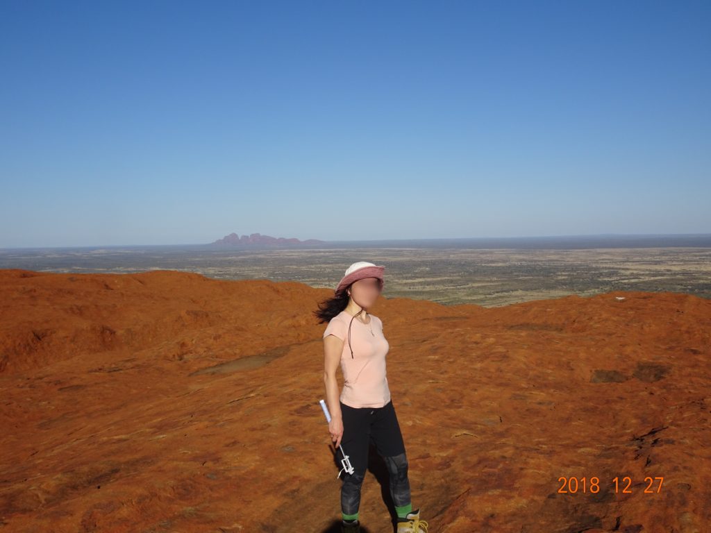
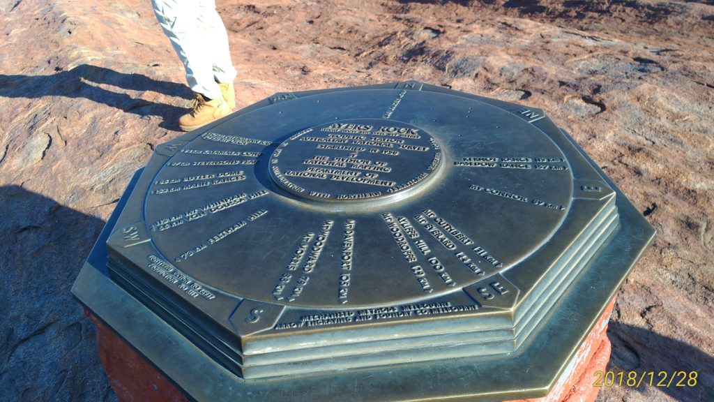
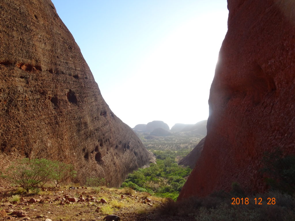
We hesitated a moment because the first slope was so steep, but I had climbed half-way before, so we were able to climb up at once. A few flies were there when we got to this elevation. As a chain was stretched over the steep slope, work gloves were useful. Be prepared to keep your small items such as sunglasses secured. As it took about 2-3 hours round-trip, we recommend not bringing heavy items. After steep slopes, up and down ridges continued. The summit was flat and wide. We could see Kata Tjuṯa, which we had scheduled to go to next.
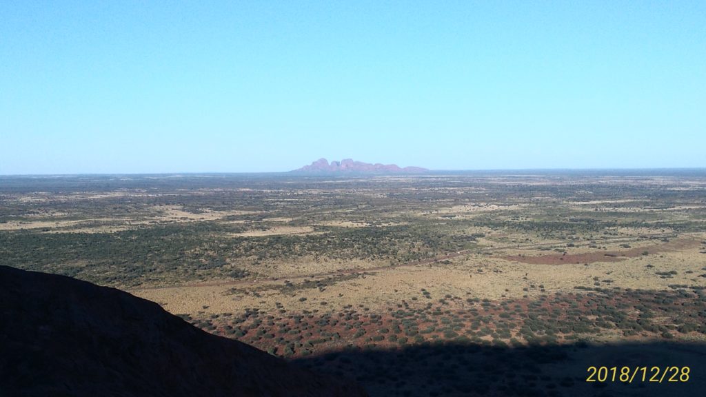
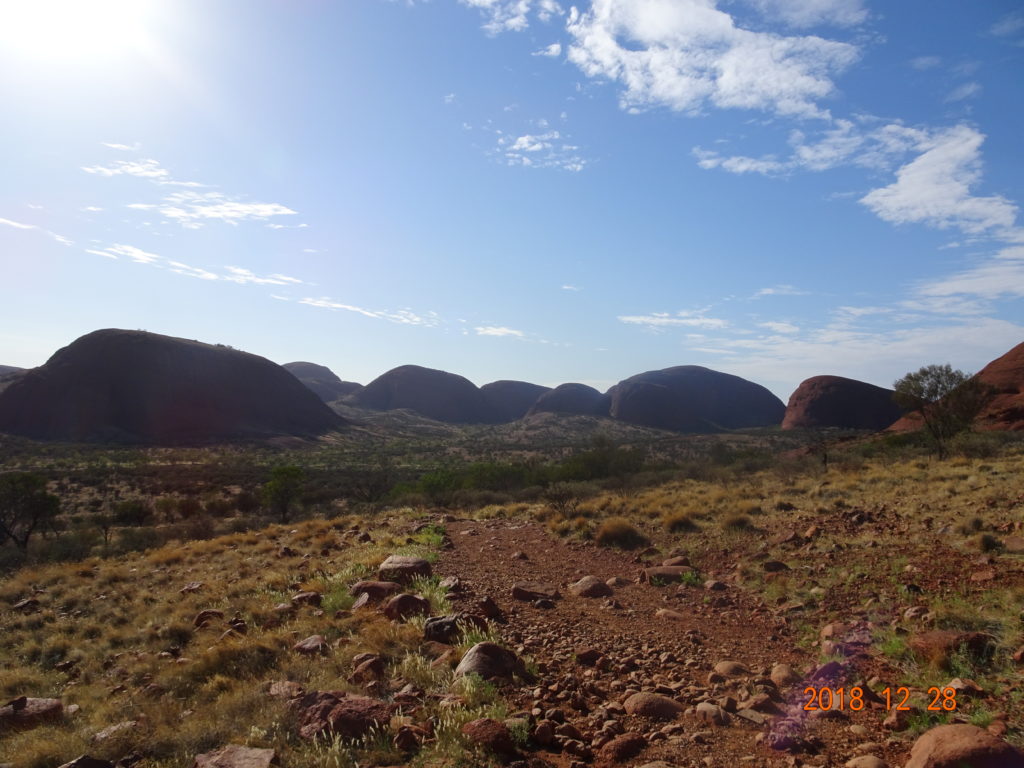
After the descent, we went ahead to Kata Tjuṯa immediately. It was around 10 A.M. when we arrived at the car park of Valley of the Winds Walk and started to walk. The temperature rose gradually. The sun got strong too. I felt slight heatstroke, so we gave up after about 1 hour and returned the way we came from. It was 48 degrees. We returned to the resort, had lunch at the restaurant, and fell asleep on the bed in our lodge.
We were scheduled to see the Uluru sunset from the resort, but we were too exhausted to get up. We were also late to Ilkari Restaurant, which we had reserved. The total for the buffet for 2 (A$73/each) and 4 glasses of beer was A$214.5 (approx. $150). The buffet menu was satisfying and included shrimp and raw oysters.
05:30 Talinguru Nyakunytjaku
05:50 Uluru sunrise
06:15 Uluru climb
09:30 Kata Tjuṯa
14:00 Lunch
20:00 Dinner at Ilkari Restaurant
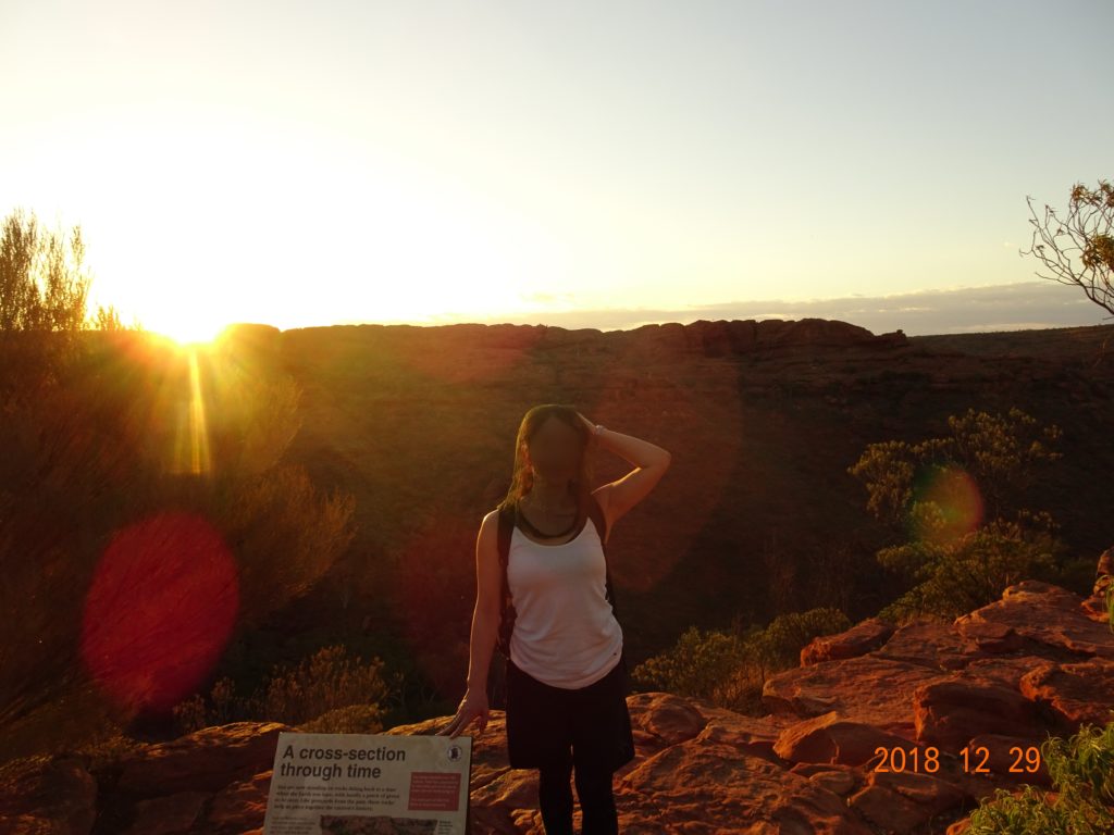
3rd day: Sat, December 29
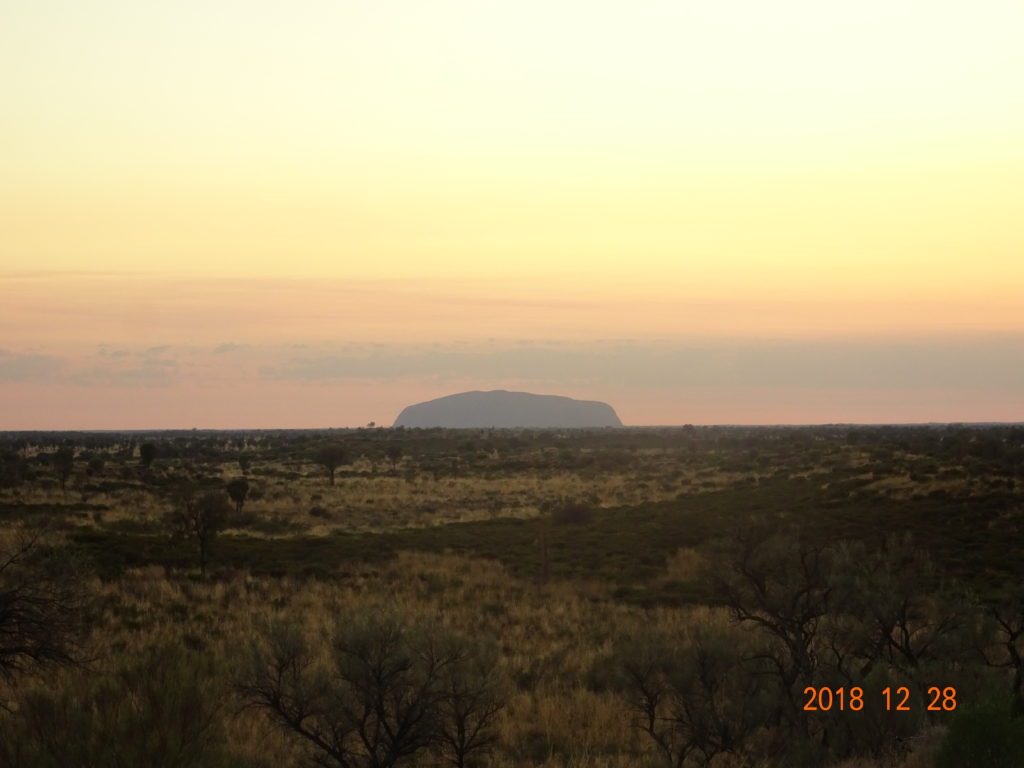
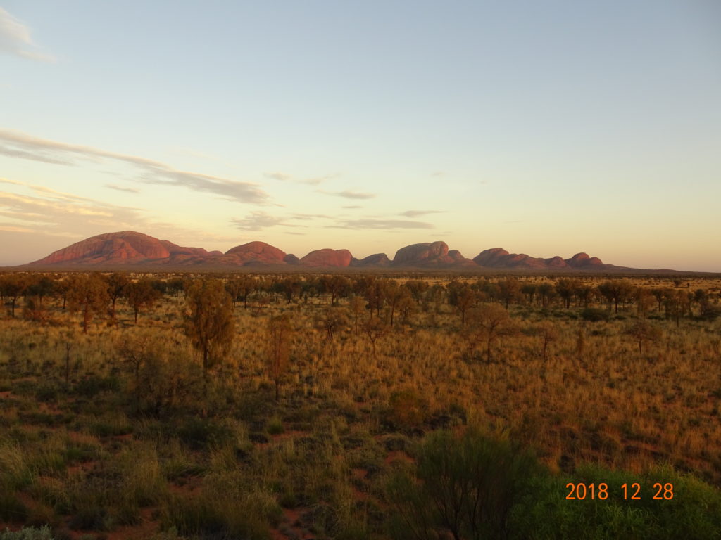
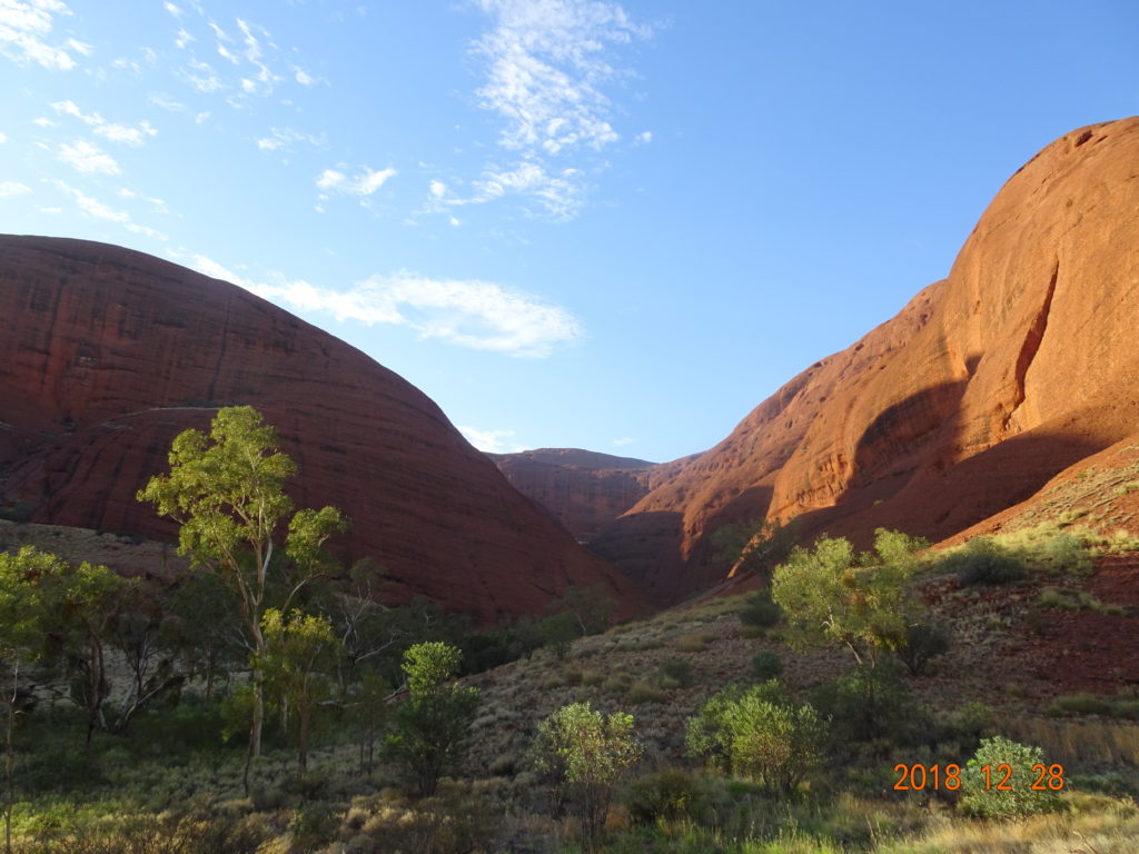
After check-out from the lodge, we went ahead to the Kata Tjuta Sunrise Viewing Platform. We could see both Uluru and the sunrise here. We could also see Kata Tjuta changing color.
After that, we moved to the car park of Valley of the Winds Walk and started to walk the same trail as the previous day. As it was earlier than the day before, we were able to walk through this time.
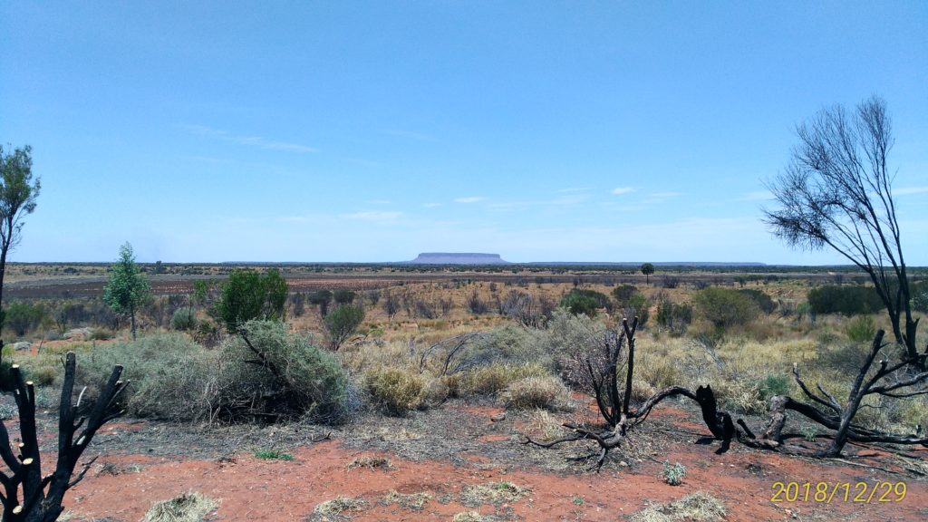
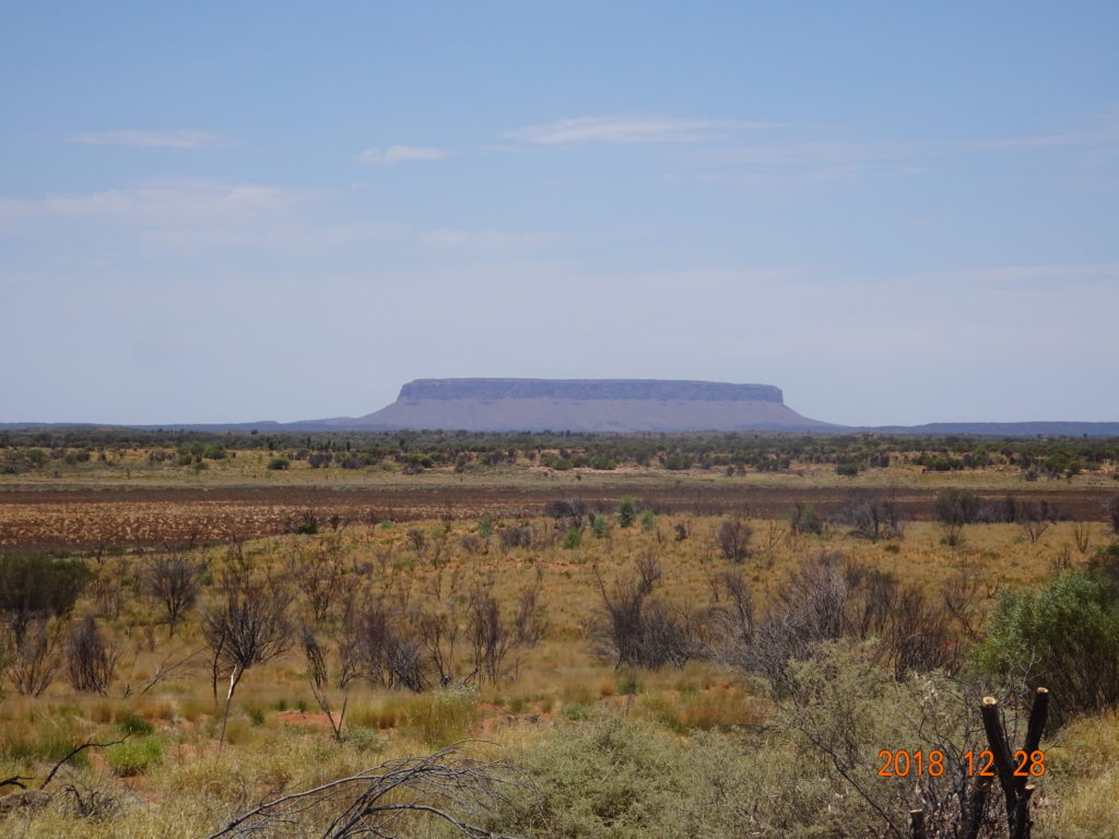
When we returned to the resort, we had lunch at a restaurant around IGA supermarket and went shopping at souvenir shops. We filled our car up with gas at the gas station in the resort and went ahead to the next destination, Watarrka National Park. We stopped by Mount Conner Lookout on the way.
We arrived at the next accommodation, Kings Creek Station, in about 3 hours. We realized that this was for campers, so the place we would stay in was a tent. I’m not sure why the infrastructure was undeveloped around here; there were only two accommodations. The other accommodation, a resort hotel, was quite expensive.
The tent was well-made. There were beds on the left and right side and a fan. When I opened the zipper in the window area, it was made from mesh fabric, so it was ventilated. There was a shared kitchen, shower rooms and toilets in the tent area.
As it was so hot in the tent, we killed time by having a beer in the restaurant. There were some camping tour groups who loaded logs and coolers on their car carriers. I guess they were going to have a barbecue.
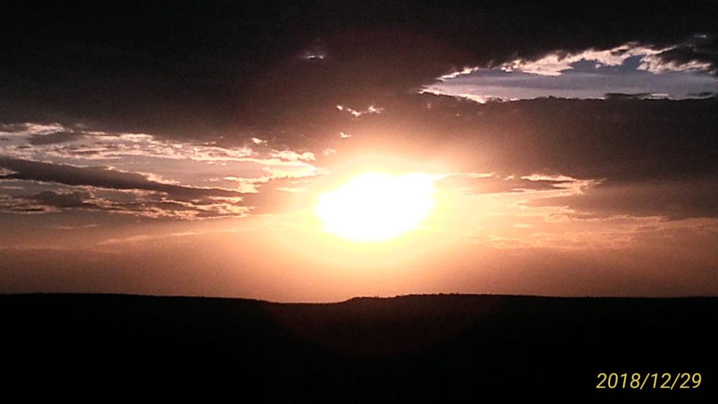
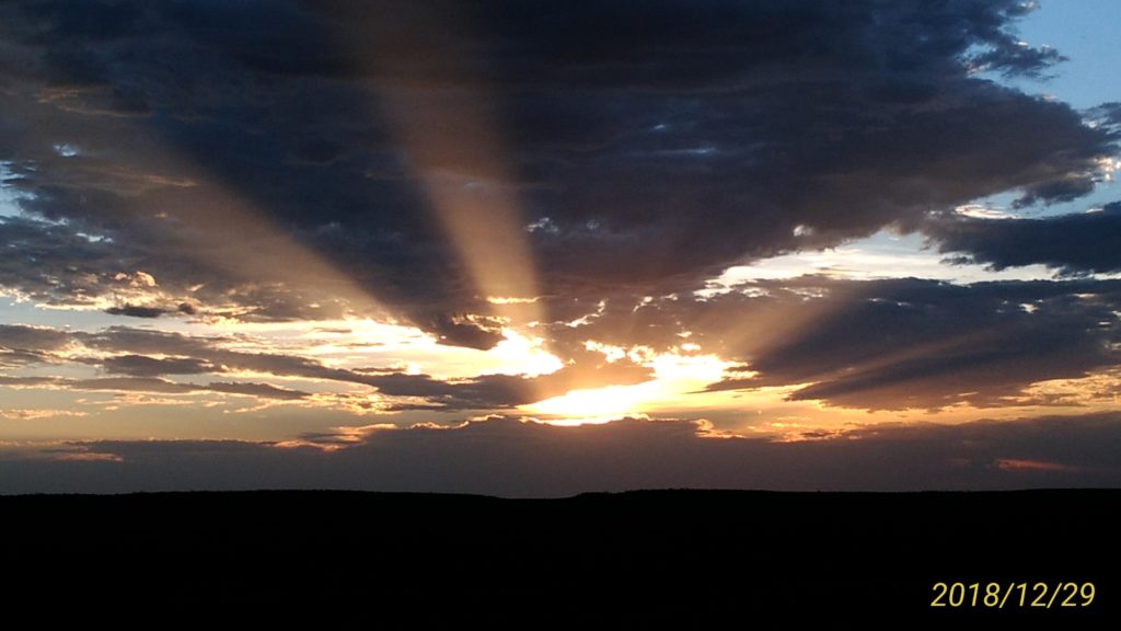
After dinner, we strolled around till sunset. The guests of the camping tour bathed in the pool. As it was still hot, we bathed our feet too. The sunset area was about a 10-min walk from there.
It got a little cool at night, but it was so hot in the tent that we woke up many times in the middle of the night.
05:30 Kata Tjuta Sunrise Viewing Platform
05:50 Kata Tjuta Sunrise
06:30 Start of Valley of the Winds Walk
11:00 Lunch
15:00 Check-in at Kings Creek Station
17:00 Dinner
19:00 Sunset
4th day: Sun, December 30
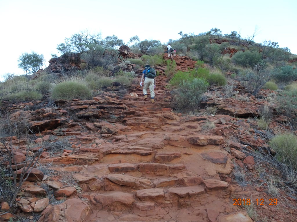
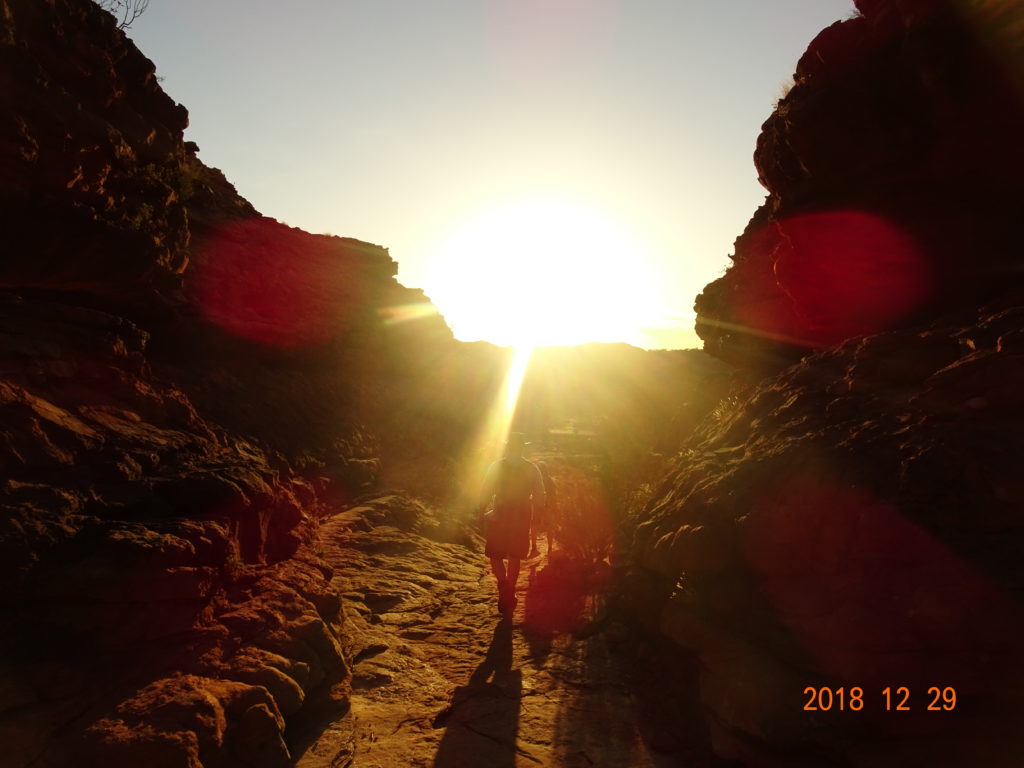
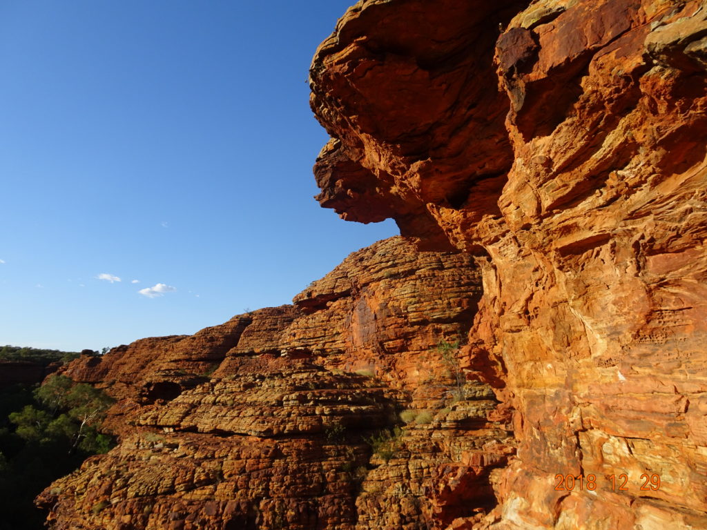
After the check-out, we went ahead to the car park of the Kings Canyon Rim Walk.
At first, the stairs continued going up, and we saw the sunrise at the end of them. We enjoyed this walking course because it had varied geographical features and floras.
We were scheduled to have breakfast at the restaurant in the resort, but everything was shut down because it was too late for breakfast. We bought Mereenie Loop Permits(A$5/each)at the convenience store for Mereenie Loop Road, which we drove to after this. This road took us through Aboriginal country.
After leaving the resort, we entered a red unpaved road, Mereenie Loop Road. This road had a lot of curves and ups and downs, so we bounced around a lot. We drove on this unpaved road for about 2 hours, and turned right to enter Namatjira Drive, and turned right again after a while to enter the unpaved road which led to Gosses Bluff Crater.
4WD was recommended on Mereenie Loop Road, but this road was restricted to 4WD only. Our car leaned because of the rough and curvy road, so we hardly sped up. After driving between rocky bluffs, there was a park in the middle of the crater. We got out of our car and climbed the path in the surrounding rocky hills, which were made by a crater. The summit was like a lookout and we could look over and around the crater.
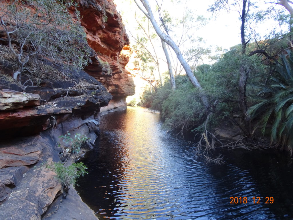
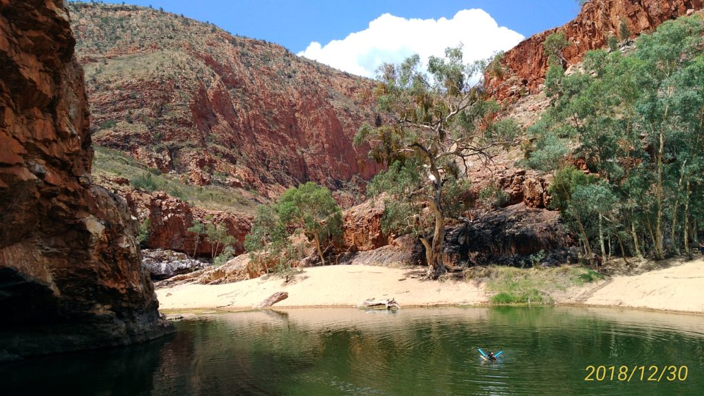
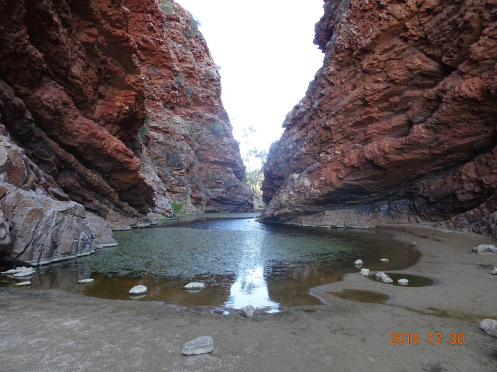
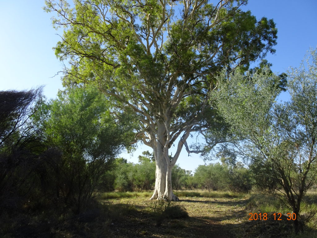
After that, we entered West MacDonnell National Park and went to Ormiston Gorge. There was a big lake after 5-min walk from the car park. As it was hot on that day too, everyone was taking a dip. We also cooled our bodies in the lake.
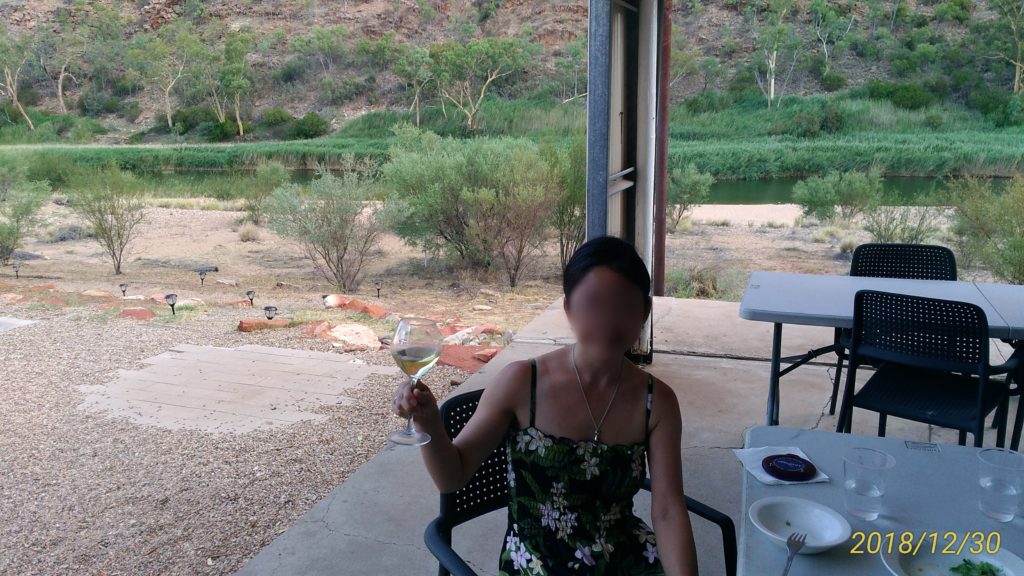
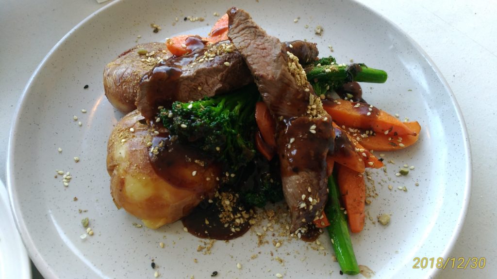
We stayed in Glen Helen Homestead Lodge on this day. It was the only accommodation around; otherwise, we would have had to go to Alice Springs town. Our room was large and included air conditioning. We had a beer in the bar because we were so thirsty and had dinner at a table on a terrace. It was A$102.52 (approx.$72) for 2 glasses of wine, a salad, and 2 main dishes.
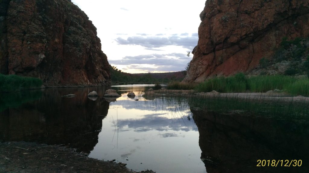
After dinner, we strolled around the lodge and went to see the Glen Helen Gorge at dusk.
06:00 The Kings Canyon Rim Walk
09:30 Kings Canyon Resort
13:00 Gosses Bluff Crater
14:15 Ormiston Gorge
15:00 Check-in at Glen Helen Homestead Lodge
18:00 Dinner
5th day: Mon, December 31
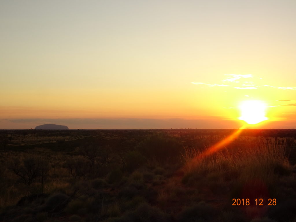
After check-out from the lodge, we went to Mount Sonder Lookout, which was nearby. We weren’t able to see the sunrise, but we could see Mt. Sonder.
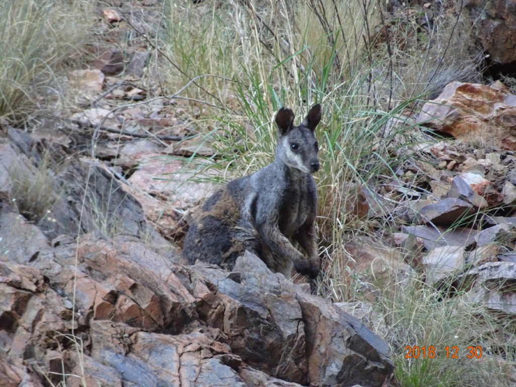
After that, we went to Simpsons Gap in a hurry. We were likely to see rock-wallabies in the early morning. We saw the sunrise in front of us on the way.
When we walked from the car park, the rocky hills appeared on both sides. Then I could see the lake and a gap. It was difficult to find rock-wallabies because of their protective color, but there were many of them on both sides of the rocky hills.
After that, we walked around the Ghost Gum Walk beside the ranger station for about 15 min.
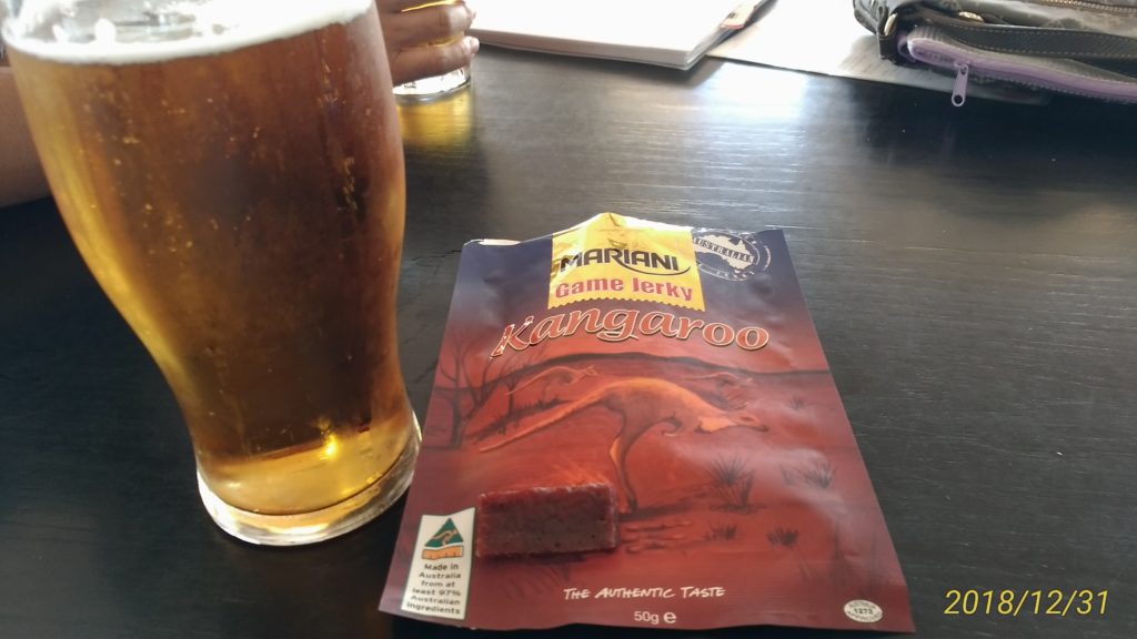
When we arrived at Alice Springs, we filled our car up with gas and had hamburgers at Hungry Jacks. We returned a rented car and killed time in the airport till the departure.
05:30 Mount Sonder Lookout
06:30 Simpsons Gap
08:30 Alice Springs
11:40 Leave Alice Springs Airport
15:50 Arrive at Melbourne Airport
Impressions
I should have planned better considering the heat at mid-day. I think it would be useful to buy a reasonable fly net before the trip.
There was little shade for a rest on any of the trails in Uluṟu-Kata Tjuṯa.
As for climbing Ayers Rock, the first slope was so long and steep. Then there were a lot of dangerous places if we went off route. At the summit, the wind blew moderately and we could look around, so I felt good.
As for the Valley of the Winds Walk in Kata Tjuṯa, it was a loop trail through valleys and fields.
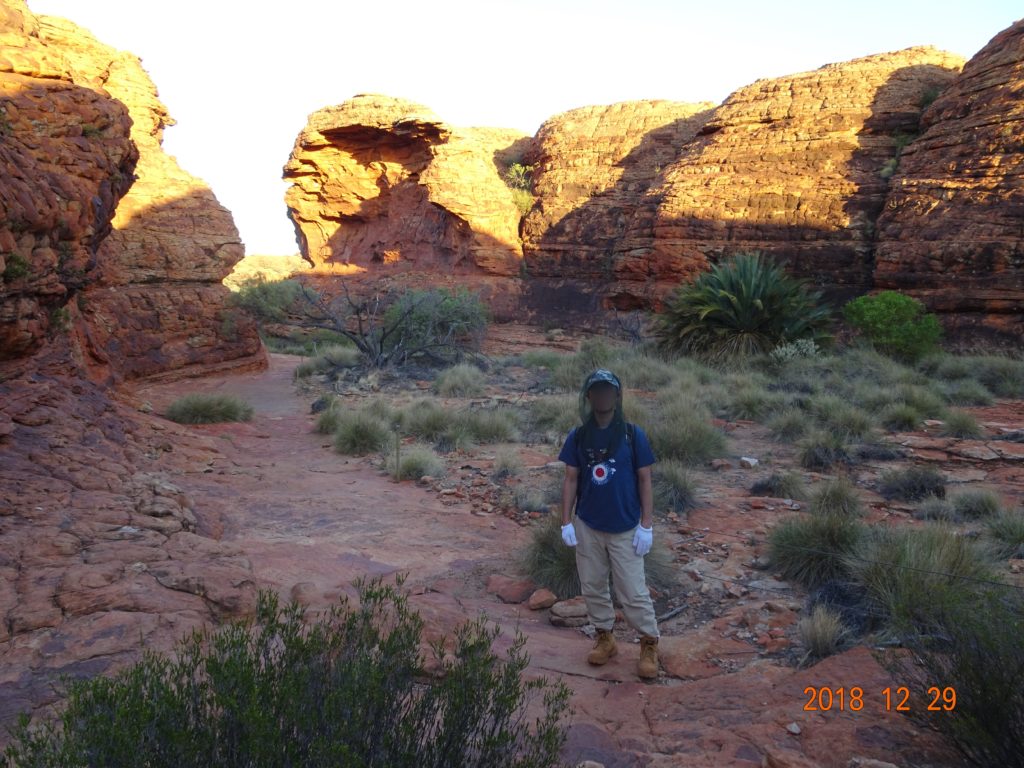
At Kings Canyon, we never got bored because the landscape had such variety, including an eroded rock labyrinth and the view of the bottom of the valley from the cliffs and the cliffs from the middle of the valley. At the bottom of the valley, the flora was thick, the river flowed, and there were some ponds too.
At West MacDonnell National Park, there were gaps or gorges and lakes in the main spots; these places were like an oasis, calm and beautiful.